The South African Weather Service (SAWS) has issued a double cold front warning for the Western Cape this week. It forecasts two cold fronts that will make landfall in the province between Monday 19 May and Wednesday 21 May 2025. As such, the service has issued weather advisories for gale-force winds and substantial rainfall. Similarly, the province will experience a marked decrease in temperatures, rough seas and the chance of snow in high-lying areas.
DOUBLE COLD FRONT WARNING
Following several days of unseasonably warm pre-frontal weather in the Western Cape, the first of two cold fronts is expected to touchdown today (Monday 19 May 2025). North-westerly winds will grow from moderate to strong throughout the day. And these will intensify into gale force winds (75 km/h) in the early hours of Tuesday 20 May 2025, as the second cold front approaches.
Accordingly, the SAWS is warning the public of potential weather-related disruptions. Therefore, on Tuesday 20 May 2025, temperatures are expected to fall to freezing in high-lying areas, making snowfall possible. Likewise, gale-force winds will register as high as 75 km/h along coastlines.
HEAVY RAIN AND ROUGH SEAS
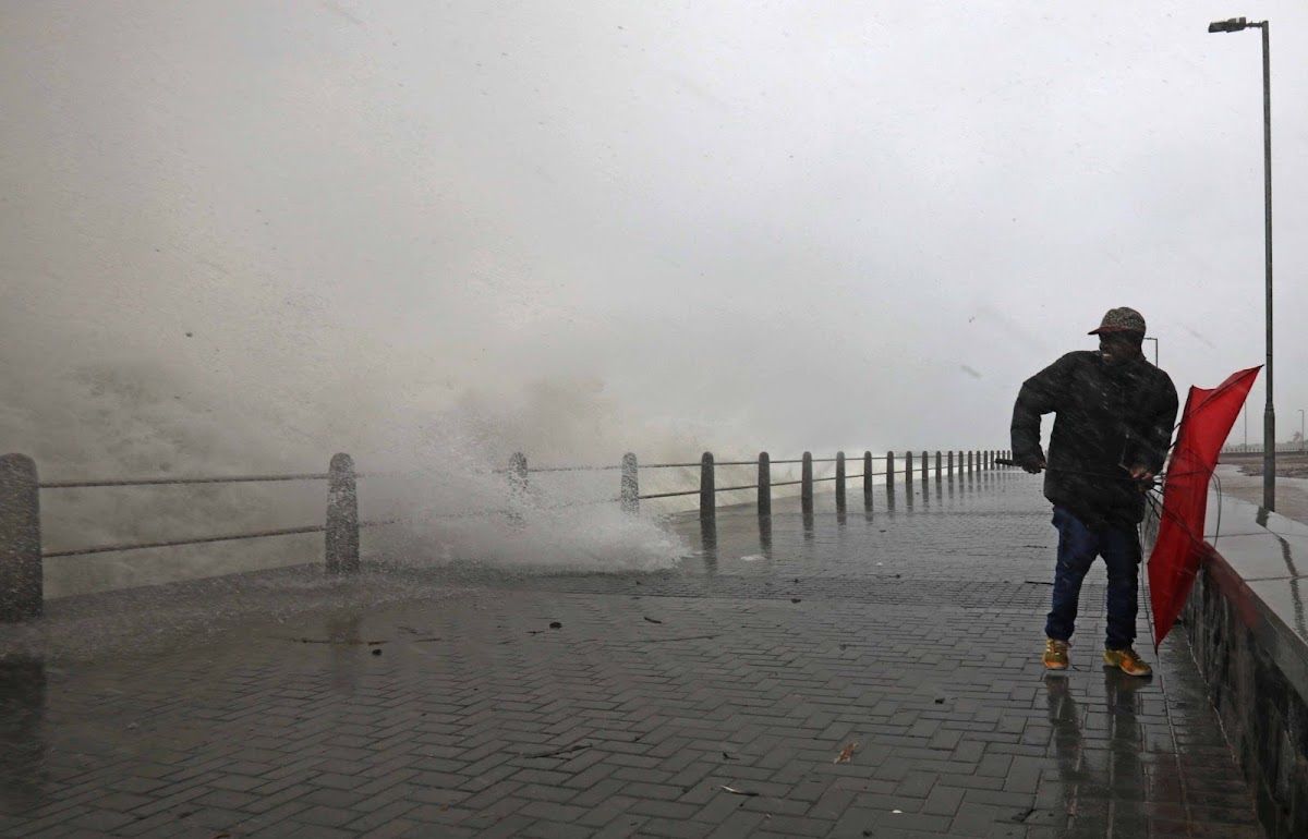
In turn, this intense system will bring about heavy rain (forecast at more than 30 mm in parts) and rough sea conditions. Therefore, SAWS warns coastal and maritime operators of possible abnormal waves in the 7-metre range on Wednesday 21 May 2025. Buildings and power lines could be affected by high winds, too.
Moreover, the cold front warning means motorists could see significant delays. Commuters are warned that strong winds will create hazards for high-sided vehicles on national routes. As this is the first significant cold front of the winter, the roads could become slick and slippery and experience localised flooding in low-lying areas, too.
LOCALISED FLOODING POSSIBLE
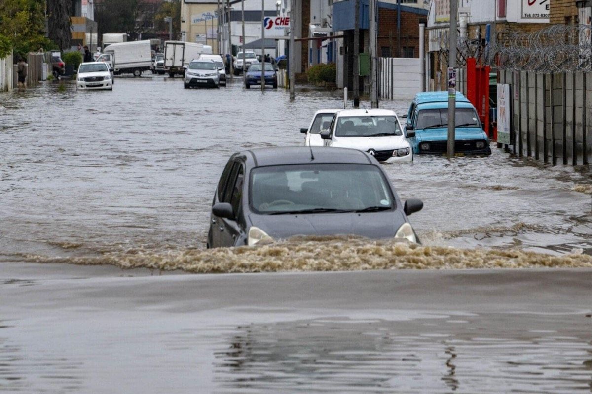
Furthermore, the cold front warning means persistent rainfall throughout Tuesday 20 May 2025. Rainfall accumulations of 30 mm are expected in central Cape Town and surroundings. Temperatures will drop significantly, with a maximum of only 14°C expected across the Cape Peninsula and adjacent areas. The cold front will move east and inland throughout the day, affecting the Boland and Overberg regions. All of which have experienced substantial flooding as a result of similar weather systems in 2024.
Rainfall intensity will decrease through Wednesday 21 May 2025, with Cape Town expecting intermittent rainfall of 5 mm. Temperatures will remain cool with a maximum of 15°C. And winds will gradually moderate but remain stiff from the north west. From the rest of the week, Thursday 22 May to Sunday 25 May 2025, weather conditions are expected to begin improving, with temperatures climbing back into the high teens and 20s.
WHAT PRECAUTIONS ARE YOU TAKING AHEAD OF THIS DOUBLE COLD FRONT?
Let us know by leaving a comment below, or send a WhatsApp to 060 011 021 1.
Subscribe to The South African website’s newsletters and follow us on WhatsApp, Facebook, X and Bluesky for the latest news.