Struggling to decide what to wear? Here’s what today’s weather has in store for South Africa’s nine provinces.
Your daily weather, UVB forecast and temperature updates around South Africa.
Weather conditions and UVB forecast
Gauteng
Temperature: Cloudy and cold with isolated showers and rain in the south. It will be cool in the extreme north.
The expected UVB Sunburn Index: Low
DID YOU KNOW
Where does Gauteng rank in size among South Africa’s provinces?
Gauteng is the smallestof South Africa’s nine provinces, with an area of 18 178 square kilometres.
Where does Gauteng rank in population among South Africa’s provinces?
Gauteng is the biggestin terms of population, with an estimated 16 million inhabitants as per the most recent census in 2020.
What is the capital of Gauteng?
The administrative capital of the province is Johannesburg,which is situated at 25°44′46″S 28°11′17″E.
Mpumalanga
Temperature: Partly cloudy and warm in the Lowveld, otherwise cloudy and cold with isolated showers and rain in the south-west.
DID YOU KNOW
Where does Mpumalanga rank in size among South Africa’s provinces?
Mpumalanga is the second smallest of South Africa’s nine provinces, with an area of 76 495 square kilometres.
Where does Mpumalanga rank in population size among South Africa’s provinces?
Mpumalanga is the sixth most populous, with an estimated 4.7 million inhabitants as per the most recent census in 2020.
What is the capital of Mpumalanga?
The capital and largest city in the province is Mbombela (formerly known as Nelspruit), which is situated at 25°27′57″S 30°59′07″E.
The daily weather forecast and temperature updates around South Africa.
Limpopo
Temperature: Fine and cold to cool, but partly cloudy in the south.
DID YOU KNOW
Where does Limpopo rank in size among South Africa’s provinces?
Limpopo is the fifth largest of South Africa’s nine provinces, with an area of 125 754 square kilometres.
Where does Limpopo rank in population size among South Africa’s provinces?
Limpopo is the fifth most populous, with an estimated 5.9 million inhabitants as per the most recent census in 2020.
What is the capital of Limpopo?
The capital and largest city in the province is Polokwane, which is situated at 23°54′00″S 29°27′00″E.
North West
Temperature: Partly cloudy, windy, and cold.
DID YOU KNOW
Where does the North West rank in size among South Africa’s provinces?
The North West is the sixth largest of South Africa’s nine provinces, with an area of 104 882 square kilometres.
Where does the North West rank in population size among South Africa’s provinces?
The North West is the seventh most populous, with an estimated 4.2 million inhabitants as per the most recent census in 2020.
What is the capital of the North West?
Its capital is Mahikeng (formerly known as Mafikeng), which is situated at 25°51′56″S 25°38′37″E.
Free State
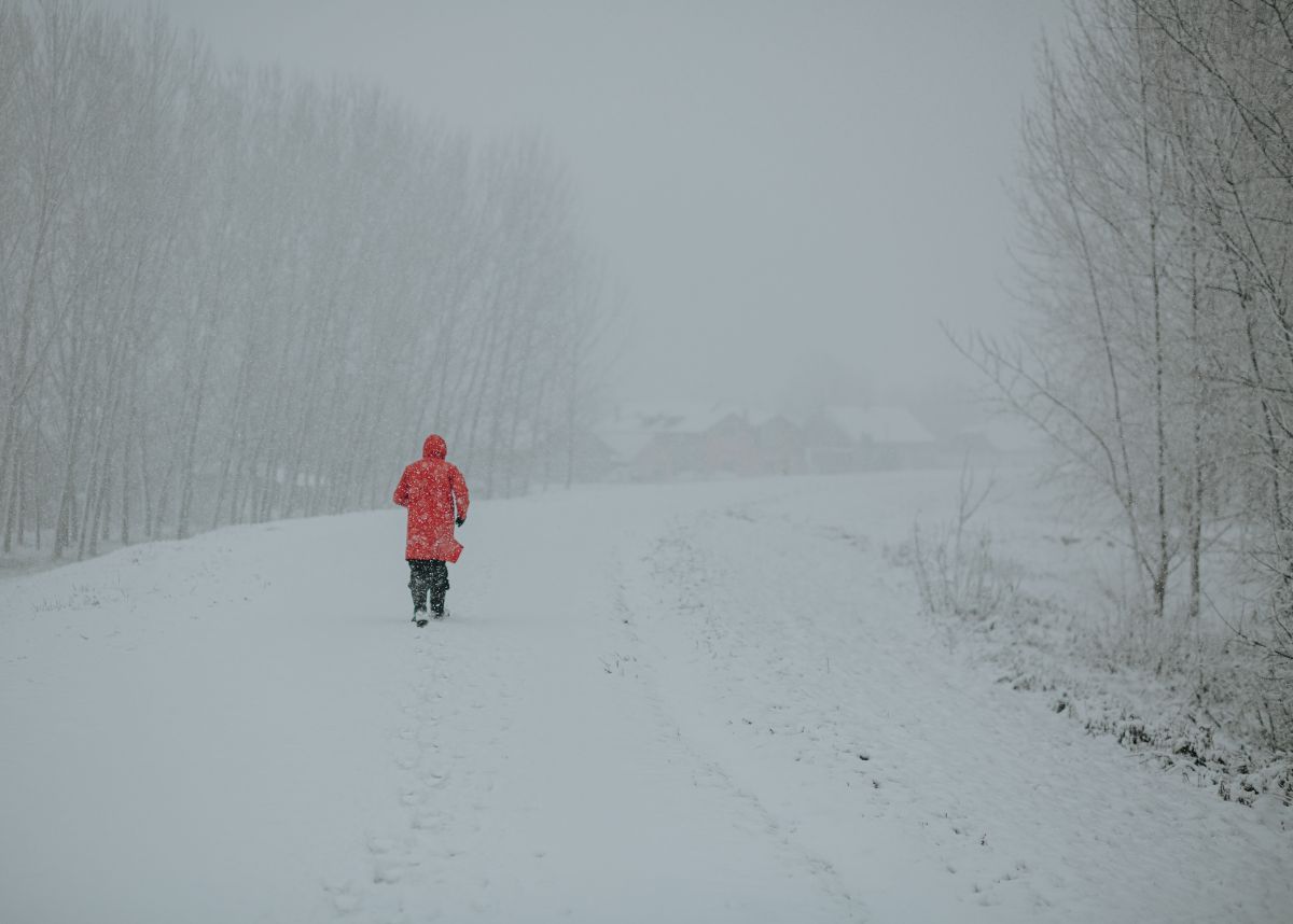
Temperature: Cloudy, windy and cold to very cold with isolated showers but scattered in the extreme south. Snowfalls are expected along the Lesotho border.
DID YOU KNOW
Where does the Free State rank in size among South Africa’s provinces?
The Free State is the third largest of South Africa’s nine provinces, with an area of 129 825 square kilometres.
Where does the Free State rank in population size among South Africa’s provinces?
The Free State is the second smallest in terms of population, with an estimated 2.9 million inhabitants as per the most recent census in 2020.
What is the capital of the Free State?
Formerly known as the Orange Free State, its capital and biggest city is Bloemfontein, South Africa’s judicial capital. It is situated at 29°07′S 26°13′E.
Northern Cape
Temperature: Morning fog in places, otherwise partly cloudy and cool to cold, but fine in the north. It will be very cold with isolated showers and snowfall in the south-east.
Wind: The wind along the coast will be moderate to fresh southerly to south- easterly.
DID YOU KNOW
Where does the Northern Cape rank in size among South Africa’s provinces?
The Northern Cape is the largest of South Africa’s nine provinces at 372 889 square kilometres.
Where does the Northern Cape rank in population size among South Africa’s provinces?
The Northern Cape is the smallest in terms of population, with an estimated 1.3 million inhabitants as per the most recent census in 2020.
What is the capital of the Northern Cape?
Its capital is Kimberley, which is situated at 28°44′18″S 24°45′50″E.
Western Cape
Temperature: Cloudy to partly cloudy and cold with isolated showers and rain in the east. It will become fine in the west from the evening.
Wind: The wind along the coast will be light to moderate south-easterly but light and variable at times along the west coast, otherwise moderate southerly to south-westerly.
The expected UVB Sunburn Index: Low
DID YOU KNOW
Where does the Western Cape rank in size among South Africa’s provinces?
The Western Cape is the fourth largest of South Africa’s nine provinces, with an area of 129 449 square kilometres.
Where does the Western Cape rank in population size among South Africa’s provinces?
The Western Cape is the third most populous, with an estimated 7.2 million inhabitants as per the most recent census in 2020.
What is the capital of the Western Cape?
The capital city is Cape Town, which is situated at 33°55′31″S 18°25′26″E.
Eastern Cape
The Western half:Cloudy and cold to very cold with scattered showers and rain but widespread along the coast and adjacent interior. Snowfalls are expected over the northern high-lying areas.
The Western half – wind: The wind along the coast will be moderate to fresh southerly, becoming south- westerly from midday.
The Eastern half: Cloudy, windy and cold to very cold with widespread showers and thundershowers. Snowfalls expected over the northern high lying areas.
The Eastern half-wind: The wind along the coast will be strong to gale force south-westerly.
DID YOU KNOW
Where does the Eastern Cape rank in size among South Africa’s provinces?
The Eastern Cape is the second largest of South Africa’s nine provinces at 168 966 square kilometres.
Where does the Eastern Cape rank in population size among South Africa’s provinces?
The Eastern Cape is the fourthbiggest in terms of population, with an estimated 6.7 million inhabitants as per the most recent census in 2020.
What is the capital of the Eastern Cape?
Its capital is Bhisho, which is situated at 32°50′58″S 27°26′17″E.
KwaZulu-Natal
Temperature: Partly cloudy and cold to cool but warm in the extreme north-east with isolated to scattered showers and thundershowers in the south, but widespread in the extreme south It will be very cold in the extreme south- west.
Wind: The wind along the coast will be fresh to strong westerly to south westerly, becoming gale to strong gale in the south.
The expected UVB Sunburn Index: Moderate
DID YOU KNOW
Where does KwaZulu-Natal rank in size among South Africa’s provinces?
KwaZulu-Natal is the seventh largest of South Africa’s nine provinces, with an area of 94 361 square kilometres.
Where does KwaZulu-Natal rank in population size among South Africa’s provinces?
KwaZulu-Natal is the second most populous, with an estimated 11.5 million inhabitants as per the most recent census in 2020.
What is the capital of KwaZulu-Natal?
The capital city is Pietermaritzburg, which is situated at 29°37′S 30°23′E.
WEATHER ALERTS
IMPACT-BASED WARNINGS
A. Orange Level 6: Disruptive snow resulting in danger to life, pass closures and communities cut-off is expected over Joe Gqabi district municipality, Enoch Mgijima (Molteno) and Matatiele local municipalities of the Eastern Cape.
B. Orange level 6: Disruptive rain leading to flooding of settlements /property, roads, danger to life with some communities temporarily cut off is expected in places over Amathole, OR Tambo as well as Buffalo City district municiplties of the Eastern Cape.
C. Orange Level 5: Disruptive rain leading to danger to life, flooding and displacements of settlements as well as mudslides is expected over Alfred Nzo, Makana, Ndlambe, Kouga, and Koukamma municipalties of the Eastern Cape.
D. Yellow Level 2: Disruptive snow leading to loss of livestock, minor passes closed and traffic disruptions due to snow and icy roads is expected over the Chris Hani district municipality, Dr Beyers Naude (Graaff Reinet), Raymond Mhlaba, Amahlathi and Umzimvubu local municipalities of the Eastern Cape.
E. Yellow Level 2: Disruptive rain leading to localised flooding of settlements, and roads is expected in places over Joe Gqabi, Chris Hani, Blue Crane Route, Dr Beyers Naude (Graaf-Reinet area), Sundays River Valley and Nelson Mandela Bay Metro municipalities of the Eastern Cape.
F. Yellow level 4 warning: Damaging winds and waves resulting in localised disruption of small harbours and/or a ports for a short period of time, small vessels at risk of taking on water and capsizing in a locality, difficulty in navigation (eg. Small vessels in short period, steep waves & hampered progress due to strong winds), and localised disruptions to beachfront activities (e.g.closure of beaches for swimming, shore/rock angling) are expected along the coast of KZN tomorrow and Wednesday.
G. Orange Level 6: Damaging winds and waves resulting in damage to settlements, some structural damage, disruption to ports/harbours and danger to vessels at sea is expected between Kei River Mouth and Port Edward.
H. Yellow Level 2: Damaging waves resulting in localised disruption to ports/ harbours, difficulty in navigation of small vessels with a risk of taking water and capsizing in a locality are expected between Port Alfred and Peddie Coast.
I. Yellow level 4 warning: Damaging interior winds resulting in localised damage to settlements (formal and informal), localised loss of agricultural production and some transport routes and travel services affected by wind or falling trees are expected in the central and northern interior of KZN.
J. Orange level 5 warning: Damaging winds resulting in injuries and danger to life from flying debris, damage to settlements (formal and informal), loss of agricultural production, some structural damage and transport routes and travel services affected by wind or falling trees are expected in the south of KZN.
K. Yellow Level 2: Damaging wind resulting in localised damage to settlements, disruption to power/communication and disruption to ports/harbours is expected in places over Buffalo City Metro, Amahlathi, Intsika Yethu, Dr AB Xuma, Elundini, Mzimbu and Matatiele local municipalities of the Eastern Cape.
L. Yellow Level 4: Disruptive rainfall resulting in localised flooding of settlements, low-lying areas, and bridges, and minor vehicle accidents due to slippery roads in the extreme south of KZN.
FIRE DANGER WARNINGS
NIL
ADVISORIES ROR WEEKEND
A. Wet, windy, and very cold conditions are expected over the southern and eastern parts of the Northern Cape, the Free State and in places in the central and southern parts of North West with the passage of cut-off low weather system, and over the Free State and the extreme south- east of Northern Cape. Snowfalls are expected along the Lesotho border and western parts of the Free State, as well as in places in the east and south-east of the Northern Cape, and along the Lesotho border, where mountain passes are likely to be closed. The public and small stock farmers are advised to provide proper shelter, dry bedding, and energy rich feed to protect their animals against these conditions.
What’s the weather like in your area?
Let us know by leaving a comment below, or send a WhatsApp to 060 011 021 1
Subscribe to The South African website’s newsletters and follow us on WhatsApp, Facebook, X and Bluesky for the latest news.
Weather forecast data provided by the South African Weather Service