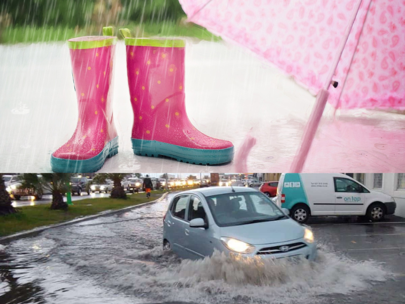
The South African Weather Service (SAWS) has issued several impact-based warnings. From Sunday, 20 October, a cut-off low-pressure system is expected to result in widespread and disruptive rainfall in the Eastern Cape and KwaZulu-Natal.
Cut-off low-pressure systems are notorious for resulting in severe weather during the Spring months. This includes heavy rainfall that can lead to flooding, intense thunderstorms accompanied by hail and damaging winds, and even tornadoes.
ADVERSE WEATHER CONDITIONS IN PARTS OF KWAZULU-NATAL AND EASTERN CAPE
The weather service said the cut-off low is expected to result in widespread and disruptive rainfall along the coastal regions and adjacent areas of the Eastern Cape and the southern and central coast of KwaZulu-Natal. This may result in minor to significant flooding in some areas.
Additionally, isolated severe thunderstorms are also possible over the eastern and central interior regions, affecting areas such as the Free State, Gauteng, North West, Mpumalanga, and parts of KwaZulu-Natal during this period.
WHICH AREAS WILL BE AFFECTED?
“The cut-off low will develop over the south-western parts of the country on Sunday, while a stationary surface high-pressure system will bring moisture to the southern and south-eastern regions.
“These systems will lead to widespread rainfall over parts of the Eastern Cape and KwaZulu-Natal mainly from Sunday to Tuesday, 22 October. Some Numerical Weather Prediction (NWP) models suggest that accumulated rainfall could reach 100 to 200 mm along the coastal areas of the Eastern Cape and the central and southern coast of KwaZulu-Natal during this period,” SAWS said.
The following impact-based warnings have been issued:
- Orange level 5 Warning: Disruptive rain leading to flooding of settlements, roads, and damage to property and infrastructure is expected along the coast and adjacent interior between East London and Port Edward today on Saturday.
- Orange Level 6 Warning: Disruptive rain, leading to flooding of settlements and roads and damage to property and infrastructure, is expected along the coast and adjacent interior between Port Alfred and Mtunzini from Sunday into Monday, 21 October.
- Yellow Level 4 Warning: Disruptive rain, leading to localised flooding of settlements and roads and damage to property and infrastructure for the Nelson Mandela Bay Metro, Kouga, Sundays River Valley, Makana, Mdlambe Local Municipality, and Ngqushwa, is expected from tomorrow through Sunday into Monday and is likely to persist until Tuesday, 22 October.
- Yellow Level 4 Warning: Severe thunderstorms with heavy downpours leading to localised flooding of settlements, low lying areas, resulting in the closure of some bridges and roads, large amounts of small hail and damaging wind to informal/formal houses or structures and vehicles are expected
over most parts of KwaZulu-Natal, the extreme eastern Free State, and the extreme southern Highveld of Mpumalanga from Sunday into Monday. - Yellow level 2 Warning: Severe storms with heavy downpours leading to localised susceptible roads, low-lying areas, and bridges, large amounts of small hail that will result in localised damage to vehicles, houses, and structures as well as localised damage to informal houses due to strong damaging wind are expected over the eastern parts of both North West and the Free State, Gauteng, the Mpumalanga Highveld and extreme northeast of KwaZulu-Natal as well as over the extreme south-west of Limpopo on Sunday into Monday.
- Yellow Level 2 Warning: From Sunday into Monday, disruptive rain leading to localised flooding of susceptible roads, low-lying areas, and bridges is expected south of the escarpment of the eastern parts of the Eastern Cape.
During this period, most parts of the country will experience warm to hot temperatures. However, due to extensive cloud cover and rainfall, cool to cold conditions can be anticipated in parts of the Western Cape, Eastern Cape, and southern KwaZulu-Natal. Calm weather conditions are expected to return on Wednesday as the cut-off low moves eastward away from the south-eastern coast.
DO YOU HEED WEATHER WARNINGS?
Let us know by clicking on the comment tab below this article or by emailing info@thesouthafrican.com or sending a WhatsApp to 060 011 021 1. You can also follow @TheSAnews on X and The South African on Facebook for the latest news.