Winter has made its presence felt as the Western Cape prepares for the next cold front to bring destructive winds, strong waves, and scattered rain across the province.
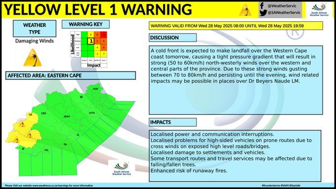
The South African Weather Service (SAWS) has issued Yellow Level 2 warnings ahead of the approaching front, which is expected to make landfall on Wednesday, 28 May.
The system is linked to an upper air trough and will impact coastal and inland areas until the weekend.
Strong winds expected
SAWS warns that northerly to north-westerly winds of 40 to 74km/h, with gusts up to 95km/h, will affect the south-west coast from Wednesday into Thursday.
Inland regions, including parts of the Western Cape and southern Namakwa District in the Northern Cape, are also expected to experience gusts of 60 to 90km/h.

Dangerous sea conditions
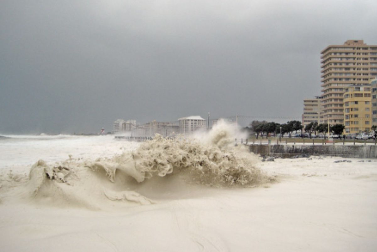
In addition to the wind warnings, a Yellow Level 2 alert for damaging waves has been issued.
The warning comes into effect at midnight on Thursday, 29 May, and will remain active until 23:00 on Sunday, 1 June.
According to SAWS, the cold front will shift southward on Thursday, generating westerly to south-westerly swells.
These swells will result in wave heights of four to six metres between Saldanha Bay and Cape Agulhas, eventually extending to Plettenberg Bay by Friday.
Coastal communities and tourists are advised to exercise caution, with authorities warning of very rough and choppy seas, as well as the high risk of being swept off rocks due to infrequent large waves.
Do you prefer the cold of winter or the warmth of summer?
Let us know by leaving a comment below, or send a WhatsApp to 060 011 021 1
Subscribe to The South African website’s newsletters and follow us on WhatsApp, Facebook, X and Bluesky for the latest news.