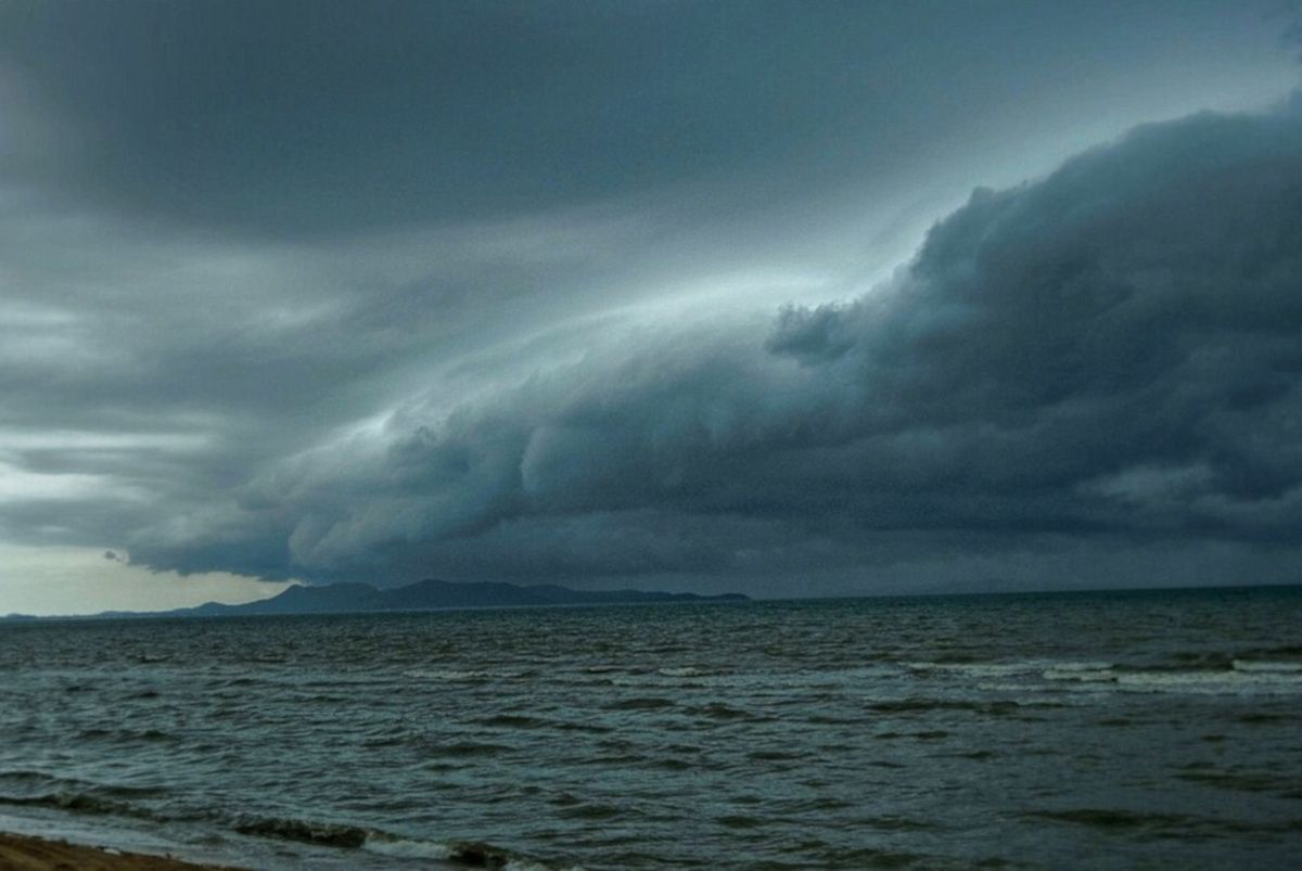
South Africans are being urged to brace for a week of wild weather as two consecutive cold fronts are expected to bring heavy rainfall, strong winds, snow, and dangerous sea conditions, the South African Weather Service (SAWS) has warned.
The first, less intense cold front will make landfall over the Western Cape on Monday, 19 May, setting the stage for a more severe system arriving on Tuesday.
The second cold front is expected to sweep across much of the country through Wednesday, 21 May, with impacts likely lasting until Friday morning, 23 May.
“Persistent and continuous rainy conditions may lead to localised floods, particularly in areas with poor drainage and low-lying regions,” SAWS said in a statement.
⚠️ Widespread weather impacts expected
The stormy conditions will be accompanied by westerly to north-westerly winds averaging 55-65km/h, with gusts up to 75km/h expected along the coastal regions from Alexander Bay to Plettenberg Bay.
Snowfall is forecast over high-lying areas as freezing levels drop considerably, while daytime temperatures across the central and eastern parts of South Africa are expected to plummet starting late on Tuesday.
SAWS has issued warnings for the following potential impacts:
- Flooding in low-lying urban and rural areas
- Damage to infrastructure, including power lines and roads
- Uprooted trees and travel disruptions
- High risks to livestock, particularly small stock
- Gale-force winds and rough seas, posing threats to small vessels and maritime activities
- Abnormal wave heights of up to 7 metres along the southern coastline
📍 Areas most affected:
- Western Cape
- Northern Cape
- Eastern Cape interior
- Namakwa District
- Southern coastline
SAWS has advised residents to stay indoors where possible, secure outdoor furniture and structures, and avoid non-essential travel.
Farmers are especially urged to protect vulnerable livestock against exposure.
“Very cold conditions, heavy rainfall, snowfalls, strong to gale-force winds and very rough seas can be expected,” SAWS warned.
Coastal residents and shipping operators are being cautioned to monitor weather alerts closely, as wave periods of 10 seconds and sea swells of up to 7 metres are forecast for Wednesday.
🧊 Cold air to linger
The wintry blast will not be short-lived.
According to SAWS, frigid conditions will extend beyond the Western Cape into the central and eastern interior from Tuesday evening, with icy mornings and sub-zero wind chills expected through Friday morning.
Are you a summer or winter person?
Let us know by leaving a comment below, or send a WhatsApp to 060 011 021 1
Subscribe to The South African website’s newsletters and follow us on WhatsApp, Facebook, X and Bluesky for the latest news.